Chapter 02 / 2026 / Vision
Deforestation Detection
A system that finds where forest has been cut down, even when clouds hide it from ordinary satellite photos. It uses radar from space, which passes through cloud, and compares eight years of it. It was built in a hackathon and won the hardest track.
What it is
The forest is under cloud
You can't count trees you can't see.
How it works
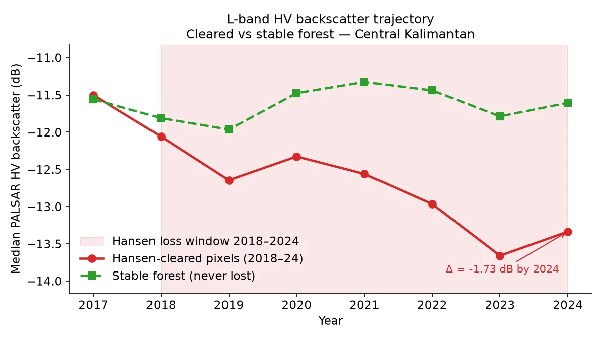
Radar instead of light
So we stopped looking and started listening to radar echoes.
What it measured
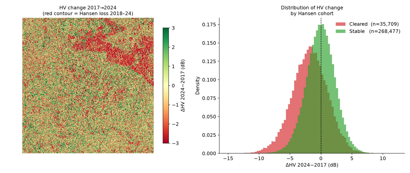
Forest loss, found by radar
6,545 hectares the clouds had hidden.